
One of the main goals of the GEOEssential project is to create cross-thematic workflows to evaluate, predict and monitor natural resources to inform via Earth Observations the Sustainable Development Goals, and other relevant environmental policy at European and national scales. The GEOEssential workshop organized in 23 – 25 April, 2018, in Palma de Mallorca, was focused on practically defining and executing these cross-thematic workflows, using the Virtual Laboratory (VLab) – cloud-based platform, developed by one of our partners – Consiglio Nazionale delle Ricerche – CNR.
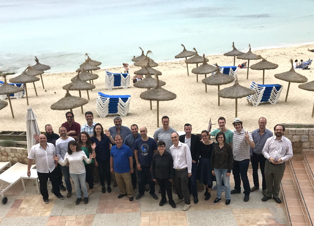
There were 24 participants, representing the majority of the partners in the project.
Achievements:
Several workflows were successfully executed during the workshop for different SDG indicators.
1. A version of the Indicator 15.1.2: (UNIGE, CNR)
This indicator calculates the “Proportion of important sites for terrestrial and freshwater biodiversity that are covered by protected areas and by ecosystem type”. In this workflow, it was calculated at country level for Switzerland following the official indicator description found on https://unstats.un.org/sdgs/metadata/files/Metadata-15-01-02.pdf.
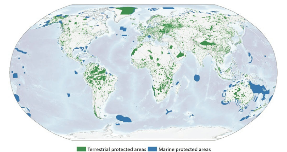
Protected areas of the World. Extracted from: Juffe-Bignoli et. al. (2014).
2. Versions of the Indicator 15.3.1: (UNIGE, SRI)
This indicator calculates the “Proportion of land that is degraded over total land area” according to the UNSTAT description – https://unstats.un.org/sdgs/metadata/files/Metadata-15-03-01.pdf.
Two versions were tested:
- One version of the indicator aimed to compute the surface of forest currently recognized that it is covered by mining concessions, at the level of the Democratic Republic of Congo.
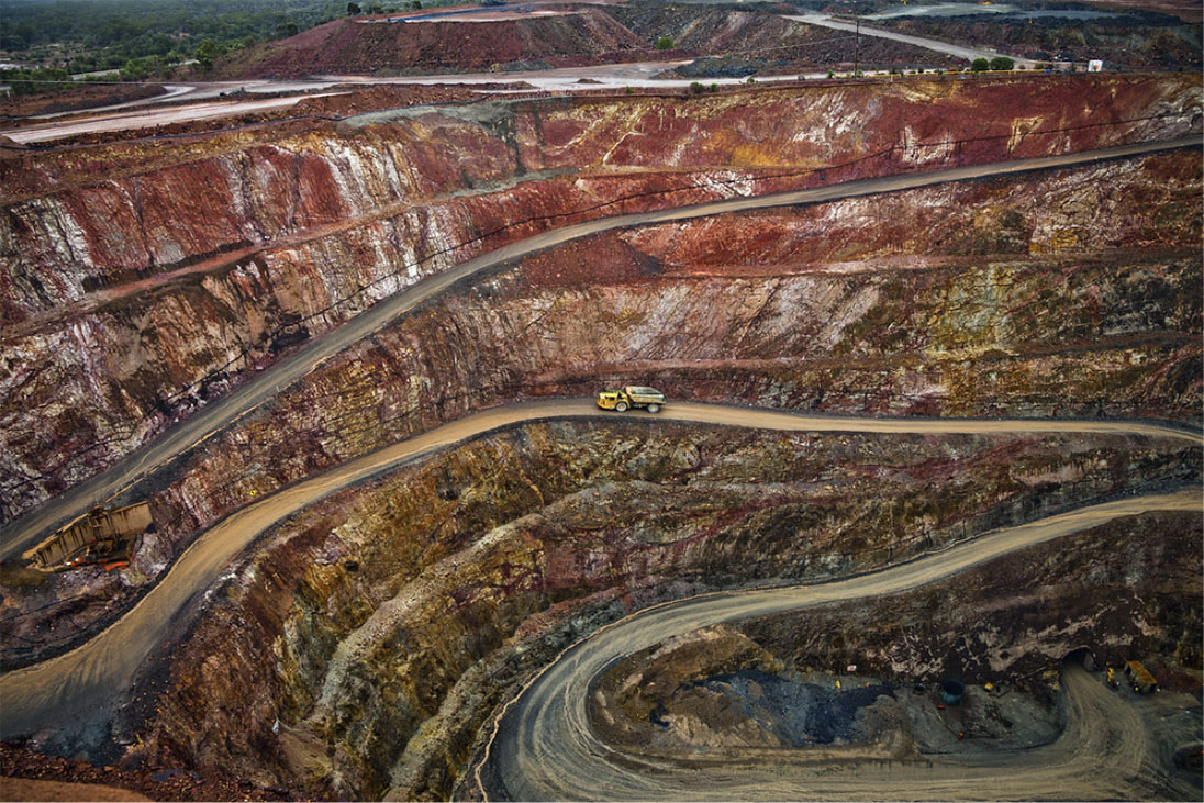
Example of impact of extractive industry
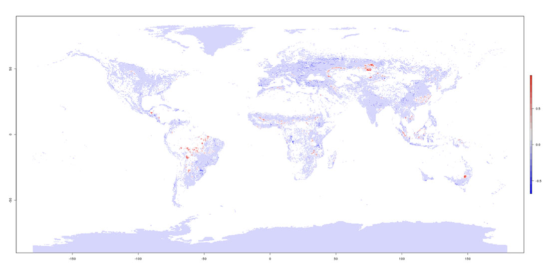
- Another version/instance of the indicator was computed at the level of Ukraine – performing analysis of land cover changes over the territory of Ukraine and their distribution over different classes of land productivity as a part of indicator 15.3.1 estimation.
3. Methods for computing Indicator 2.4.1: (SRI)
This indicator was tested for the territory of Ukraine: “Proportion of agricultural area under productive and sustainable agriculture”. It was estimated using classical approach for part of the territory of Ukraine. The first method is close to the classical approach to land productivity estimation based on the NDVI index trend change as a proxy of land productivity. The second method is based on the essential variables derived from land cover and land use classification maps (LULC) as well as outputs from biophysical model WOFOST.
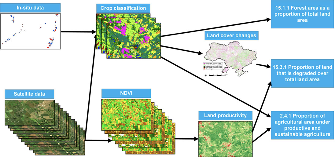
Data Processing Chains for workflows. Source: SRI
4. New indicator workflow: (SGN)
Land Cover is the physical characteristics of the land’s surface regardless of activities taking place on land. The rate of change from Natural characteristics to anthropogenic characteristics has been widely used as an indicator of anthropogenic land degradation. The aim of this indicator is to illustrates the spatial changes in the proportion of land cover in Urban and Cultivated Areas over time.
Tate of change from Natural characteristics to anthropogenic characteristics
5. Workshop general achievements:
Through this collaborative exercise, the GEOEssential partners were able to:
- Experiment and train on the cloud-based VLab platform, currently connected to Amazon Cloud.
- Train on additional tools necessary to build the workflows in VLab: GitHub, Docker.
- Learn about machine learning techniques.
Furthermore, the workshop was used to prepare the first project Newsletter, discuss further the concept of Essential Variables and the related knowledge base, and progress on coming up deliverables.
Next steps on the workflows:
The next challenge for GEOEssential is to execute new workflows over the VLab platform for instance on the Nexus approach (based on WOFOST model) for estimation the indicator 2.4.1, as well as to estimate the indicator 15.3.1 with use of own developed cropland productivity map for the territory of Ukraine and available soil carbon stock products.
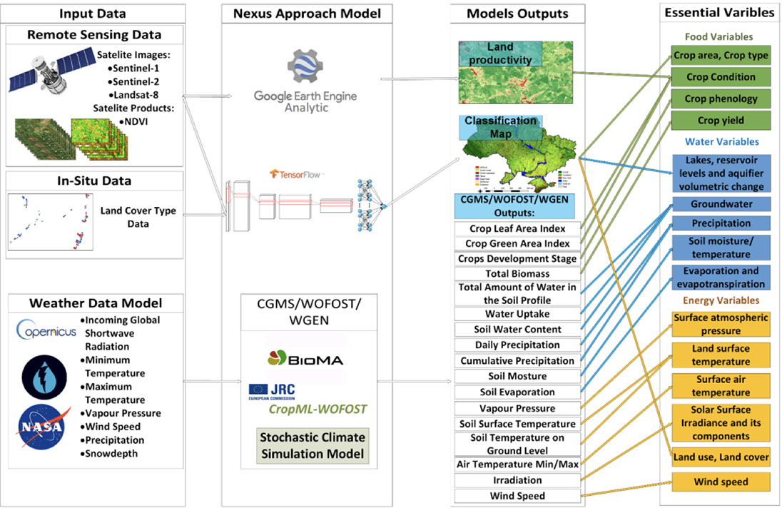
Nexus Approach for Essential Variables estimation. Source SRI
Future workflows are also envisaged around the TerrSys Modeling Platform proposed by our partner from our FZJ partner. TerrSys focusses since its setup in October 2012 on numerical simulations of variable complexity of terrestrial systems processes across scales and the advancement of the use of supercomputing facilities in terrestrial research.
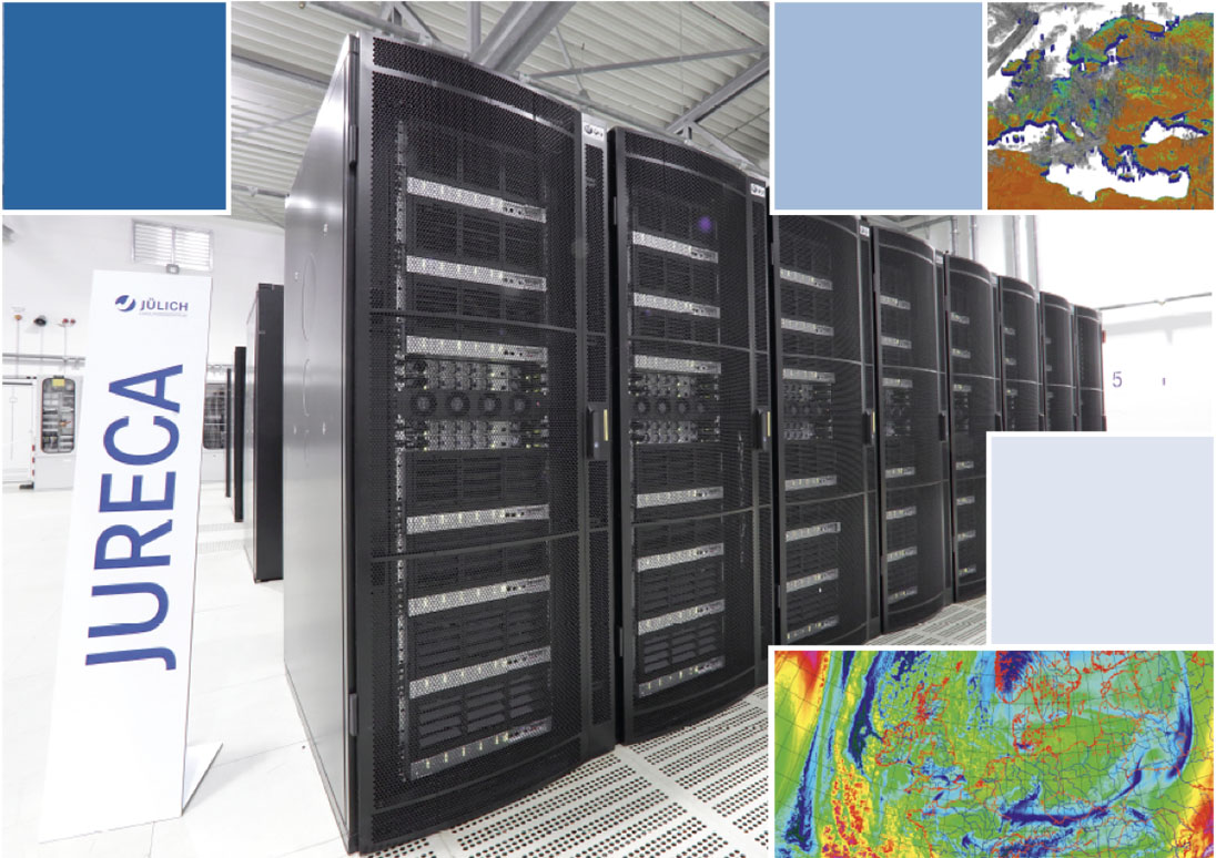
Juelich Research Centre IT infrastructure, home of TerrSysMP model
Many other workflows have been identified:
- Drought Severity at EU level; and in-situ cal/val on soil moisture (JFZ)
- Workflow on accuracy of in situ sensor location, and data compression and machine learning on soil moisture (UNDP)
- Workflow based on GLOBIOM outputs (will try to focus on energy workflow) (IIASA)
- Workflow based on soil organic matter distribution (GFZ)
- SWAT: water/nexus related workflow (UNIGE)
Conclusions
The technical solution offered by our CNR partner to build workflows on their VLab appeared to be adapted to the need of GEOEssential and almost ready to be implemented at large scale. The next two years of the project should allow to both improve the VLab platform and to build more complex relevant workflows to address policy needs at various scales.